Hubbard Scientific
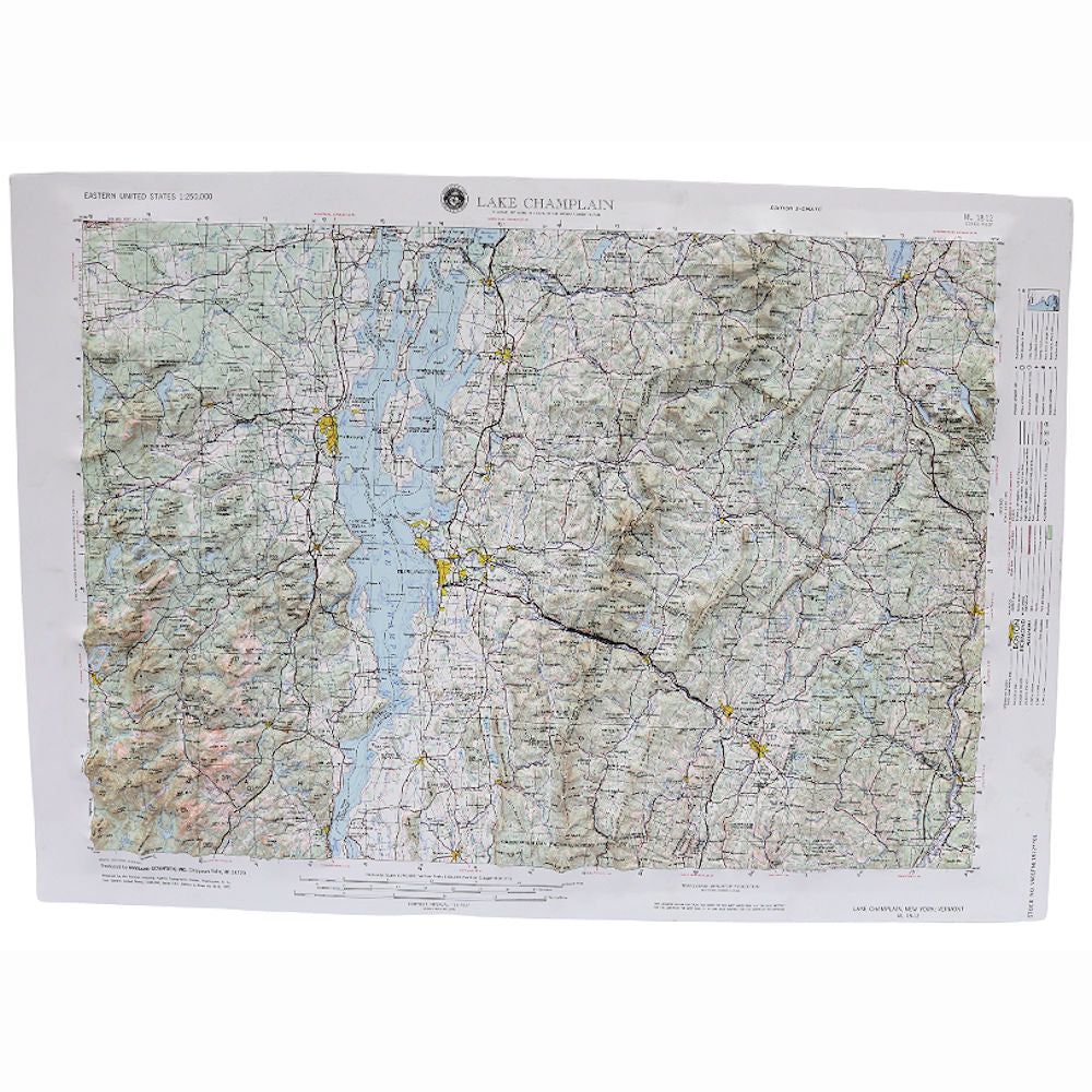
Hubbard Scientific Lake Champlain, New York; Vermont Raised Relief Map, Unframed -


Raised Relief Maps are superior visual references that give a new perspective. Not only do these maps show you the beauty of the land, they allow you to touch a scaled representation of the mountains and valleys. Fully three-dimensional, these vacuum-formed vinyl maps also use color and shading to represent elevation changes so you get a better understanding of the terrain and landforms. These maps are unique wall decor for home or office.
Map Specs:
- Scale: 1:250,000 or 1 inch is approximately 4 miles.
- Size: Approx. 21″x 29″
- Style: Raised Relief Map
- This map covers portions of New York, New Hampshire and Vermont.
- Coverage: Latitude: 44°-45° North / Longitude: 72°-74° West